Svalbard, formerly known as Spitsbergen, consists of a group of islands in the Arctic Ocean, which are situated far north of the Arctic Circle and about 1000 kilometres south of the North Pole. Three large islands dominate the territory: Spitsbergen, Nordaustlandlet, and Edgeøya. The other six main islands are Barentsøya, Prins Karls Forland, Kong Karls Land, Kvitøya, Hopen, and Bjømøya.
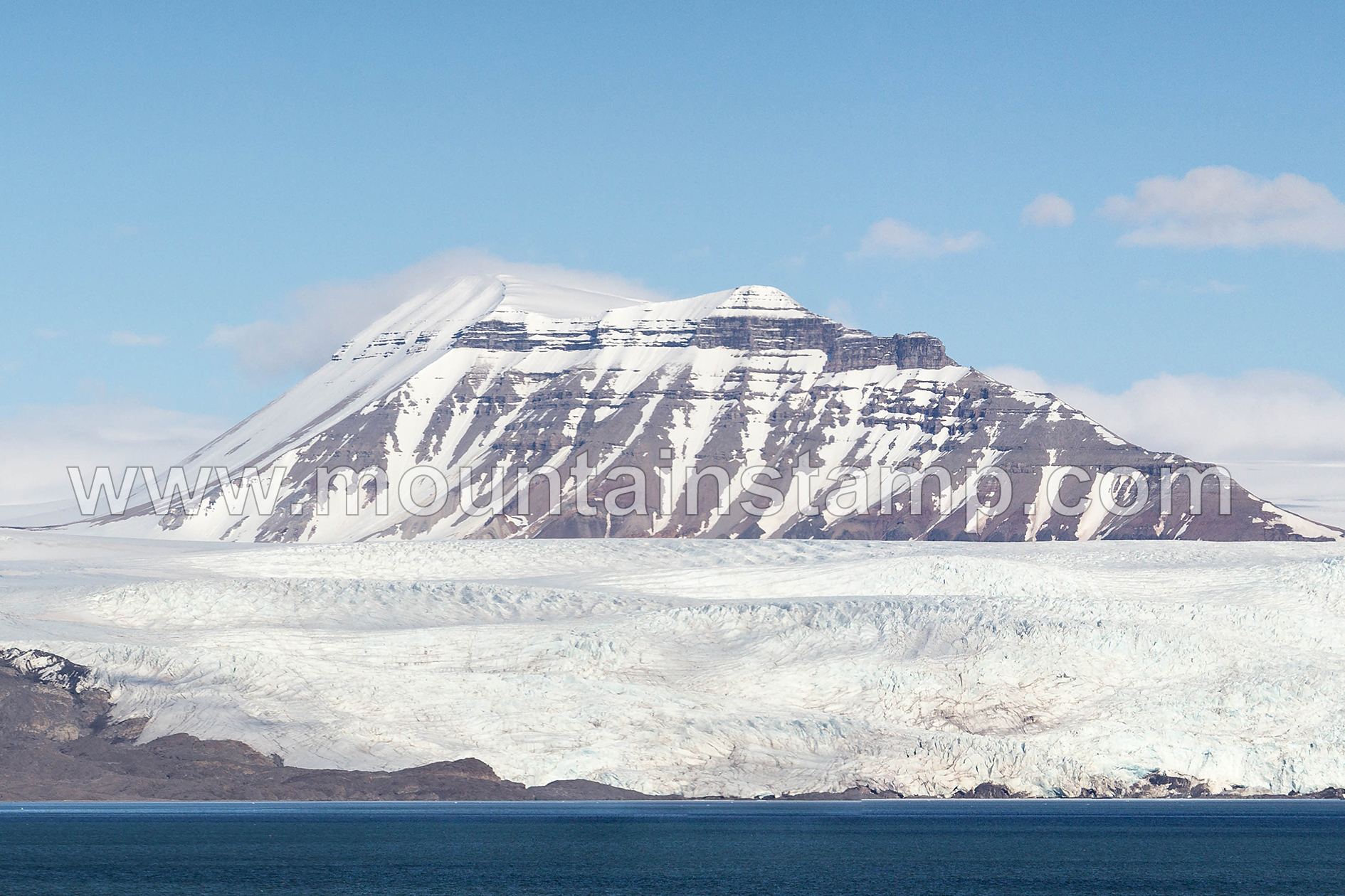
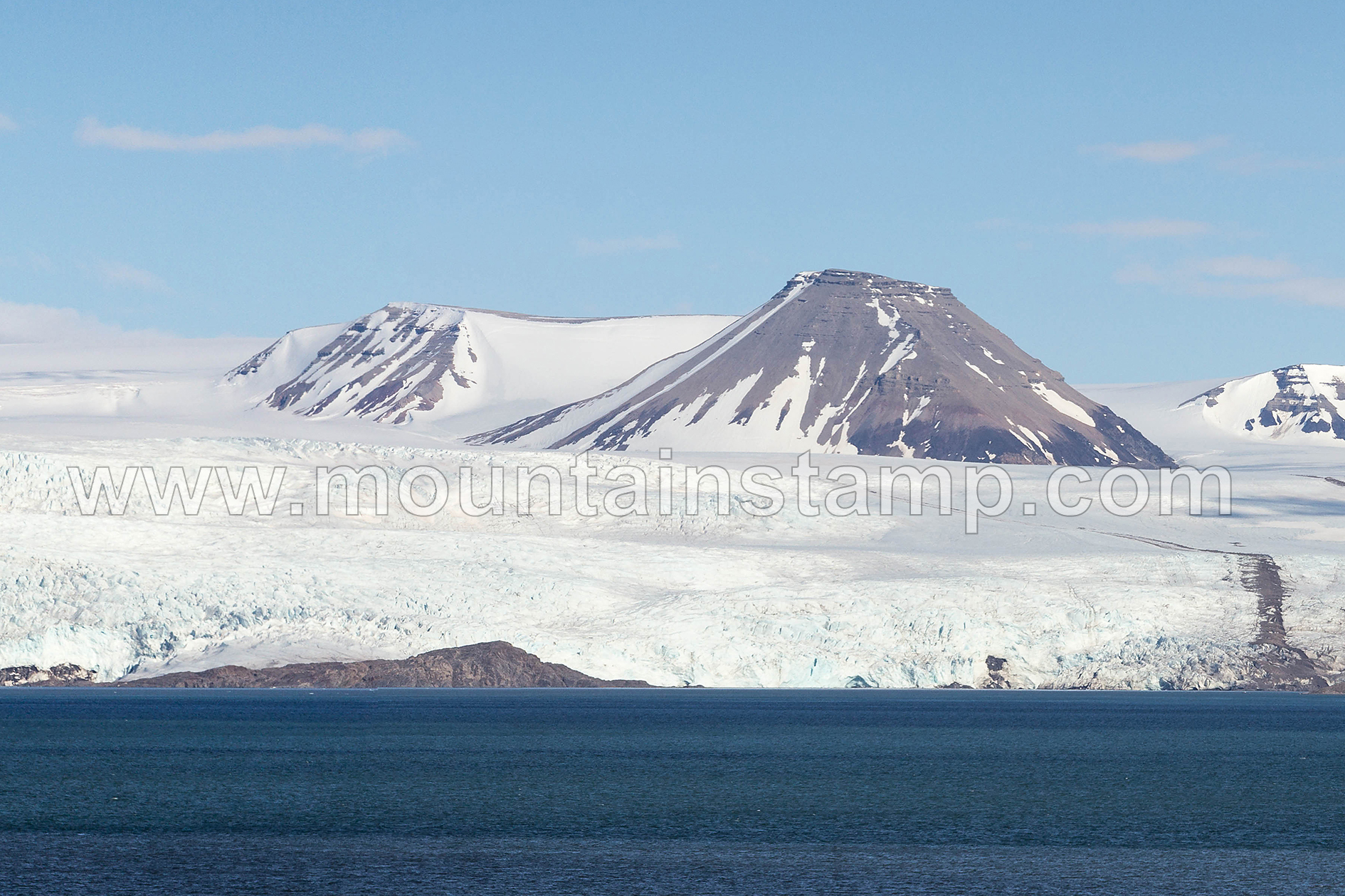
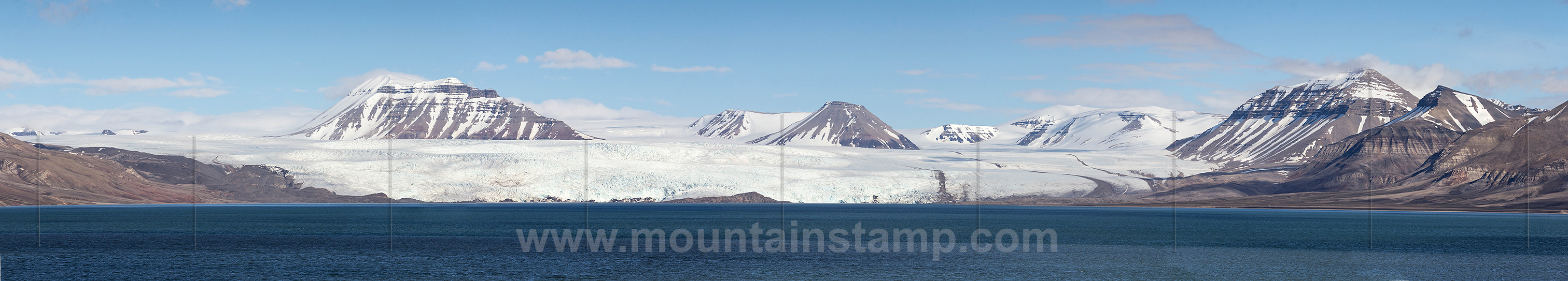
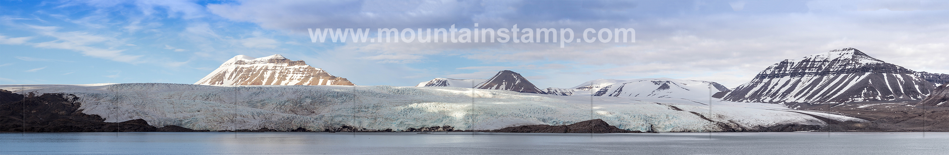
The huge glacier Nordenskiöldbreen is dominating much of the scenery at the southeastern end of the Billefjorden. It is a 25 km long and 11 km wide glacier debouching into Adolfbukta innermost in Billefjorden, on the divide between Dickson Land and Blinsow Land. The glacier is named after professor Baron Adolf Erik Nordenskiold, 1832-1901, Swedish geologist and Arctic explorer. (source "The Names of Svalbard", Norwegian Polar Institute).
Spitsbergen panorama, Billefjorden with Nordenskiöldbreen.
image (3079 85) size: 17122px x 3583px
Click on the image to enlarge it to full-screen display in panorama viewer.
Spitsbergen panorama, Billefjorden.
Billefjorden is a 30 kilometres long and 6 kilometres wide branch of the Isfjorden. It is named after the Dutch whaler Cornelius Claeszoon Bille, recorded to have been active in 1675. (source "The Names of Svalbard", Norwegian Polar Institute).
image (3058 75) size: 34652px x 3357px
Click on the image to enlarge it to full-screen display in panorama viewer.
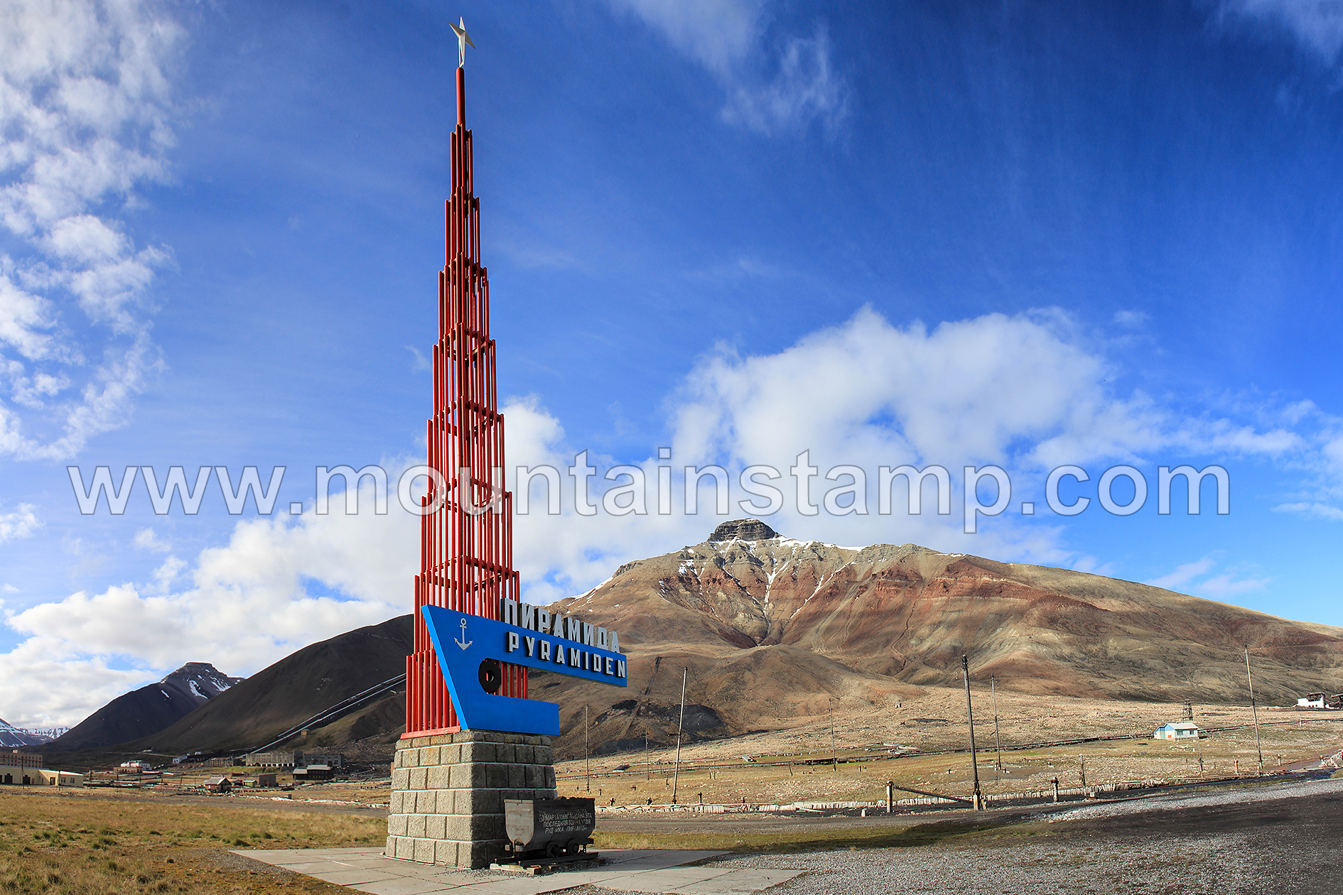
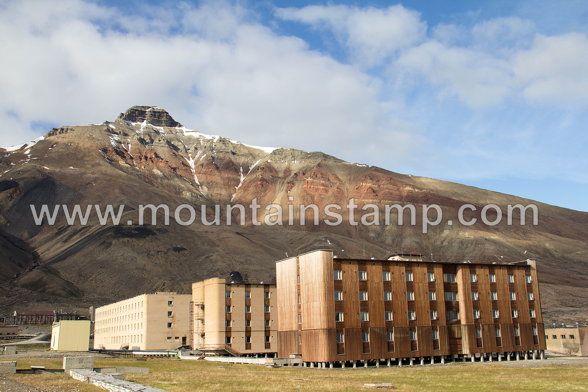
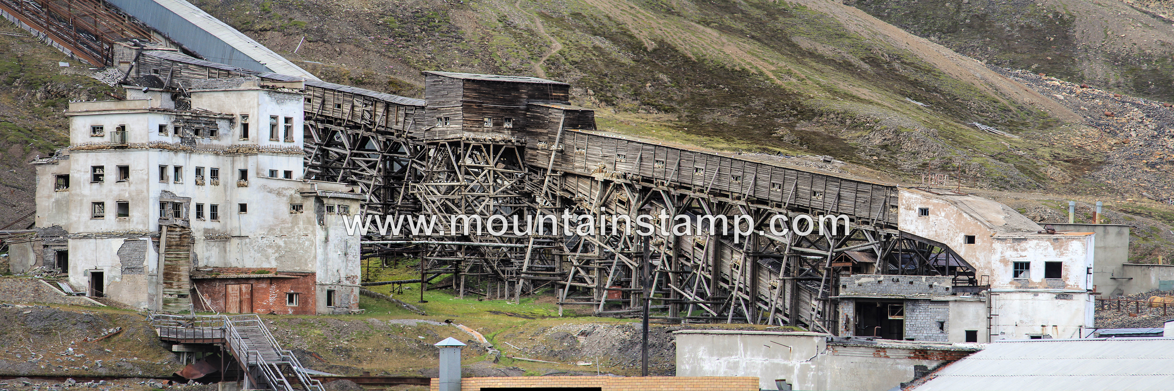
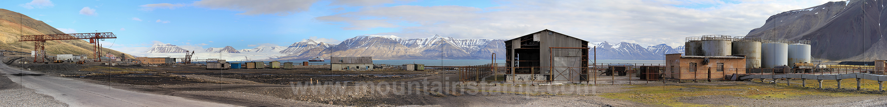
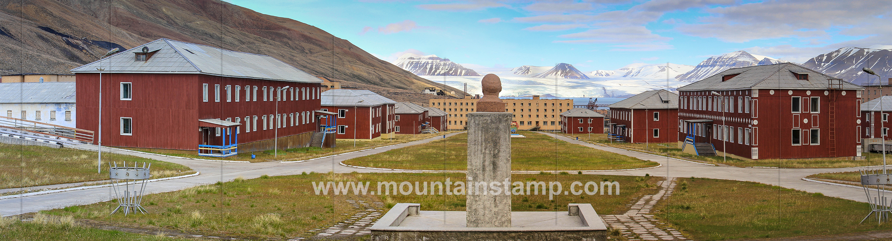
Pyramiden founded by Sweden in 1910 and sold to the Soviet Union in 1927. Goal mining until 1998 when the settlement was closed down. Pyramiden is located at Billefjorden on the southern side of the mountain Pyramiden. In the 1980s, the mining community had a population of more than 1'000. Pyramiden is now mostly visited by seagulls, polar foxes and, not infrequently, polar bears. The ghost town is now home to about eight people, who work at the hotel and as tourist guides. It’s possible to stay at the very authentic Pyramiden Hotel. image (3097 08) size: 26792px x 3256px
Click on the image to enlarge it to full-screen display in panorama viewer.
Spitsbergen panorama, Pyramiden.
Pyramiden settlement with Mt. Pyramiden 937 m.
image (3163 68) size: 10947px x 3261px
Click on the image to enlarge it to full-screen display in panorama viewer.
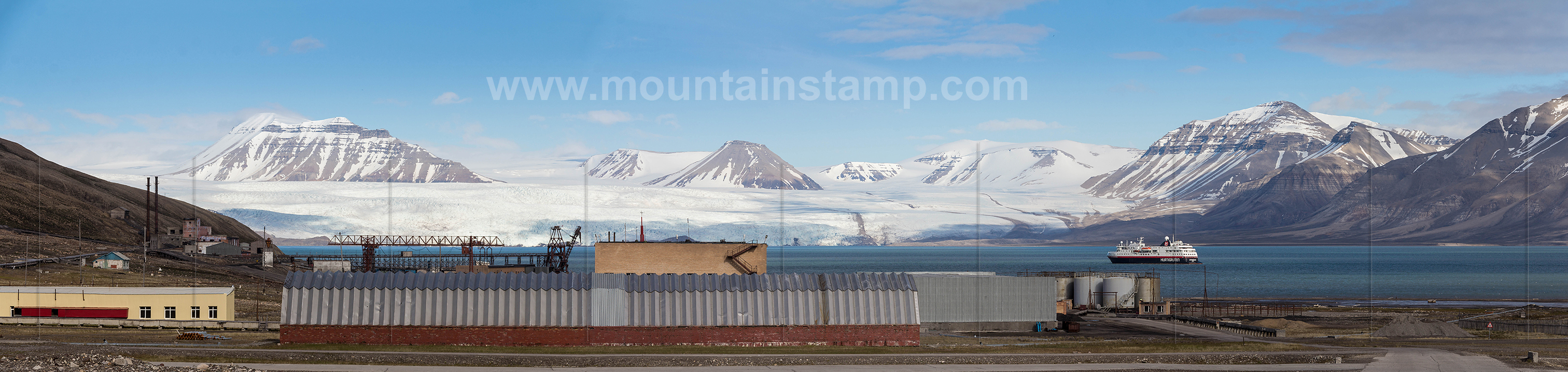
Spitsbergen panorama, Pyramiden.
Pyramiden settlement with Nordenskiöldbreen and MS Spitsbergen.
image (3232 37) size: 13934px x 3372px
The Nordenskiöld Glacier (named afer Finnish geologist Adolf Erik Nordenskiöld (1832–1901)) is 25 kilometres long and 11 kilometres wide.
Click on the image to enlarge it to full-screen display in panorama viewer.
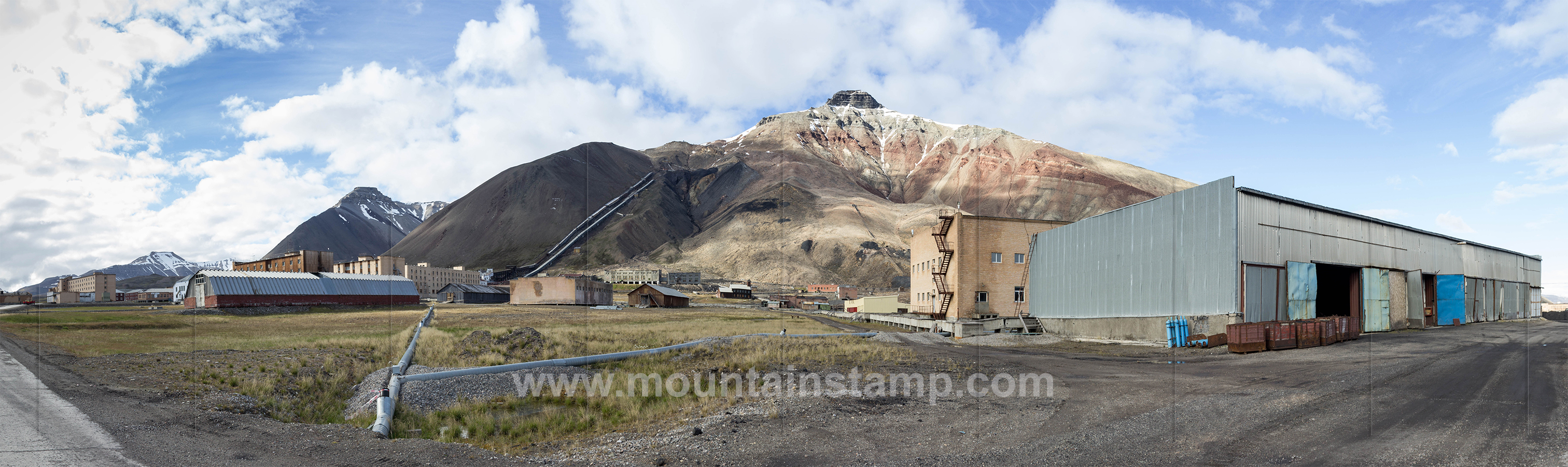
Spitsbergen panorama, Pyramiden.
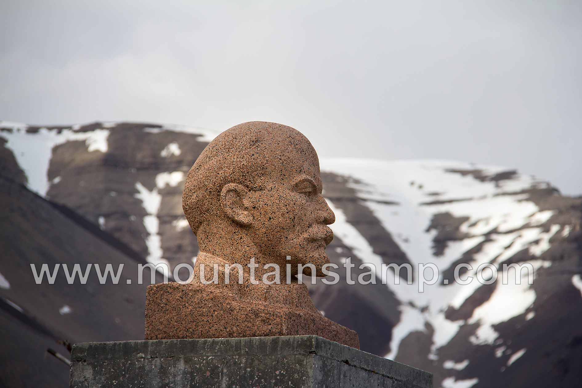
A view from the entrance to the Cultural Palace in Pyramiden.The Lenin statue overlooking the town square in Pyramiden.
image (3376 81) size: 13332px x 3652px
Click on the image to enlarge it to full-screen display in panorama viewer.
Spitsbergen panorama, Nordenskiöldbreen.
image (3453 62) size: 20422px x 3339px
Click on the image to enlarge it to full-screen display in panorama viewer.
Spitsbergen panorama, Nordenskiöldbreen.
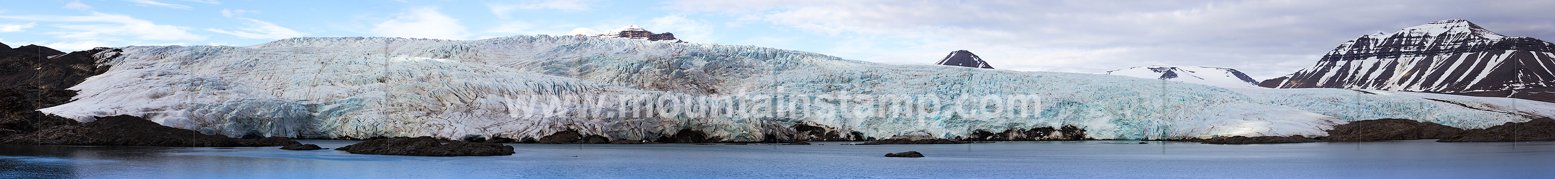
The massive ice front of the Nordenskiöldbreen.
image (3499 05) size: 18688px x 2156px
Click on the image to enlarge it to full-screen display in panorama viewer.
Pyramiden & Nordenskiöldbreen
(video and animated panoramic images)