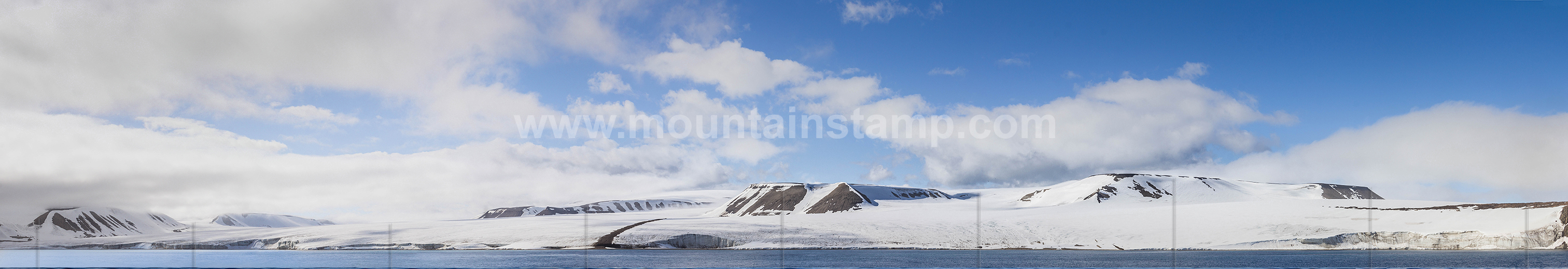
Sjuøyane is the northernmost part of the Svalbard archipelago and is a group of seven islands. The Hinlopen strait is between Spitsbergen and Nordaustlandet. It is 150 kilometers long and 10 to 60 kilometers wide.
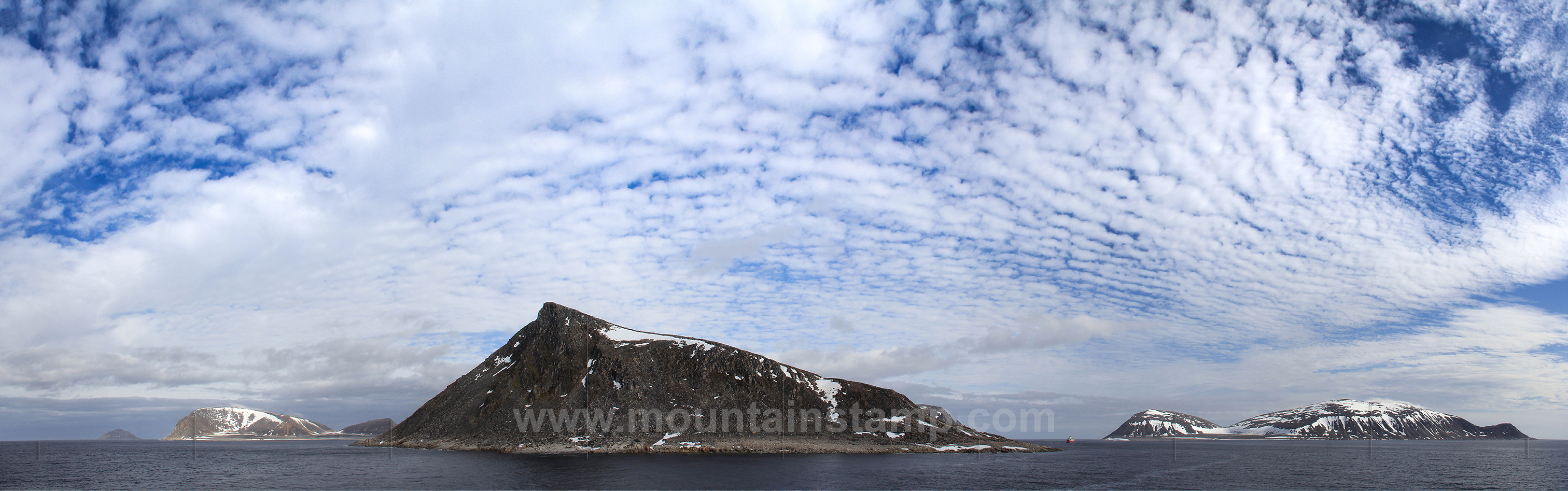
Spitsbergen panorama, Sjuøyane archipelago.
Sjuøyane archipelago is the northernmost part of the Svalbard.As the name implies, this is a group of seven islands: Phippsøya, Martensøya, Parryøya, Nelsonøya, Waldenøya, Tavleøya and Rossøya.
A view from in front of Utkiksnosa (220m) a small mountain on Phippsøya island. Phippsøya is 11 km long and the largest istand in Sjuøyane. It is named after Constantine John Phipps, second Baron Mulgrave, 174 4-92, British nava! officer, leader of the expedition in 1773 to Spitsbergen in the bomb vessels "Racehorse" and "Carcass", himself in command of the former.
In the far background left behind is the small Tavleøya island and at the right the Martensøya island. (source "The Names of Svalbard", Norwegian Polar Institute).
image (0491 96) size: 13068px x 4088px
Click on the image to enlarge it to full-screen display in panorama viewer.
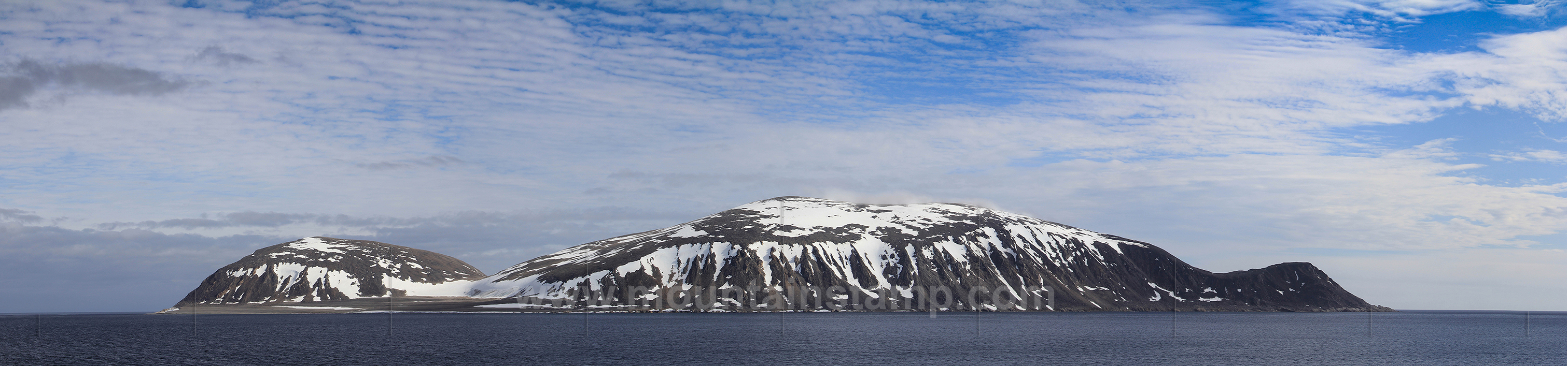
Spitsbergen panorama, Sjuøyane archipelago.
Martensøya island (viewed from the southwest) is the easternmost of the archepelago and is named after the German physician Friderich Martens, who visited Spitsbergen in 1671 and wrote a remarkable book about it in 1675. The island was visited by Swedish geologist O. M. Torell and Swedish geologist and Arctic explorer A. E. Nordenskiold on August 1, 1861, who ascended its summits. Total area 19 sq.km. Highest point: Sölvberget, 405 m.a.s.l.. (source "The Names of Svalbard", Norwegian Polar Institute).
image (0507 12) size: 15892px x 3722px
Click on the image to enlarge it to full-screen display in panorama viewer.
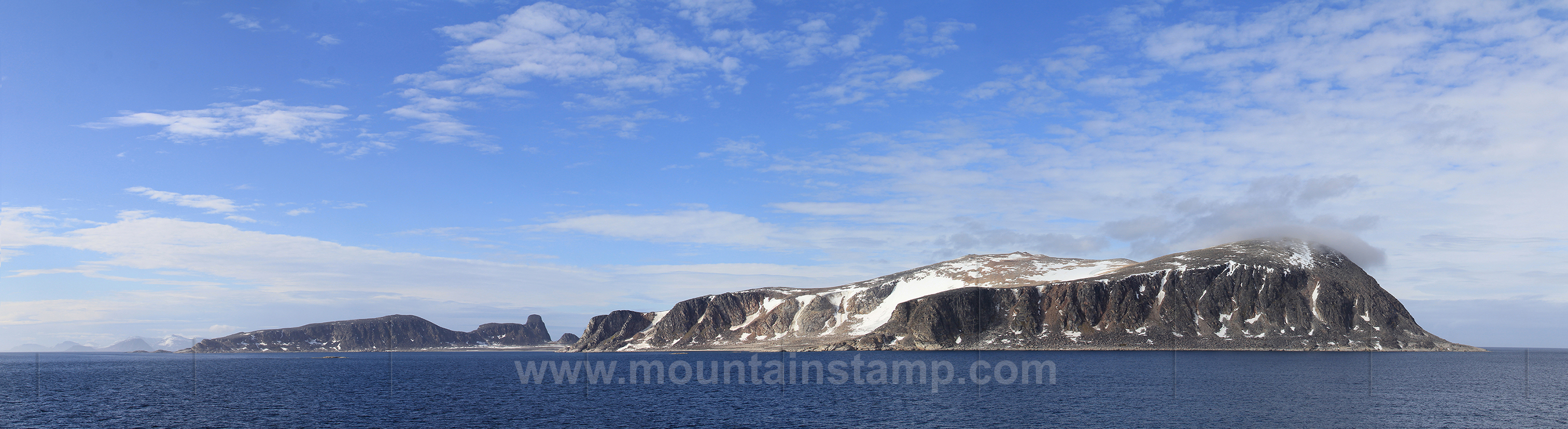
Spitsbergen panorama, Sjuøyane archipelago.
Parryøya island (viewed from the northeast) is the southernmost of the three large island in Sjuøy;ane and known after Sir William Edward Parry, English naval officer and polar explorer, who headed expedition to Spitsbergen in 1827. Total area ca. 20 square kilometres, highest point Øykollen ca. 400 m.a.s.l. (source "The Names of Svalbard", Norwegian Polar Institute).
image (0516 22) size: 15771px x 4314px
Click on the image to enlarge it to full-screen display in panorama viewer.
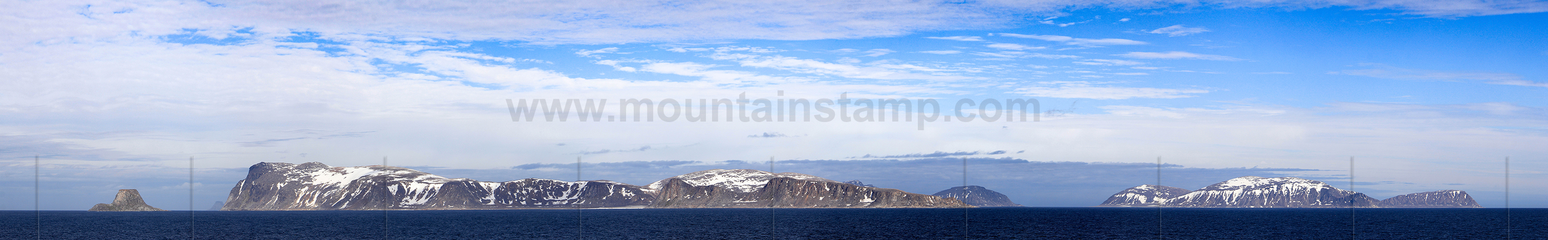
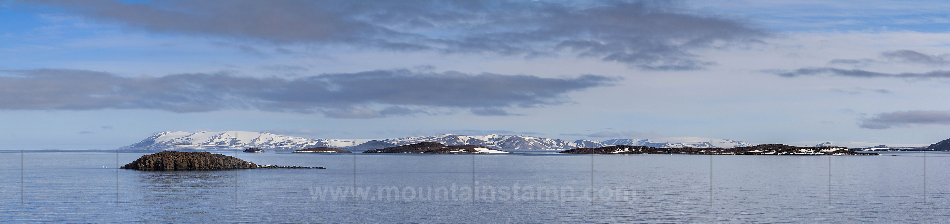
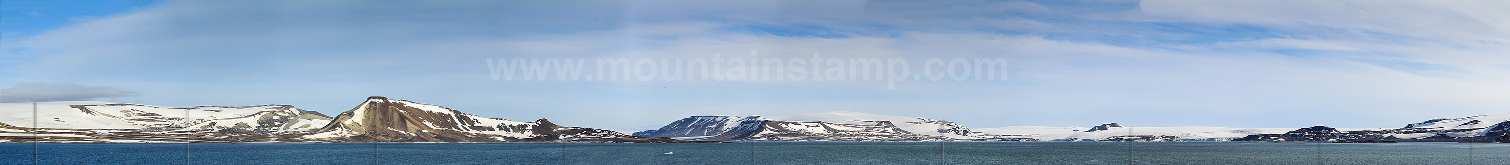
Spitsbergen panorama.
The Sjuøyane archipelago seen from the south.
The small island at the left is Nelsonøya. In the far background at the left side of the large Parryøya island (foreground) is also slightly visible in the haze the flat topped Tavleøya island and behind the right of Parryøya is part of Phippsøya island. The large island at the right side is Martensøya. (source "The Names of Svalbard", Norwegian Polar Institute).
image (0641 49) size: 27602px x 4818px
Click on the image to enlarge it to full-screen display in panorama viewer.
Click on the image to enlarge it to full-screen display in panorama viewer.
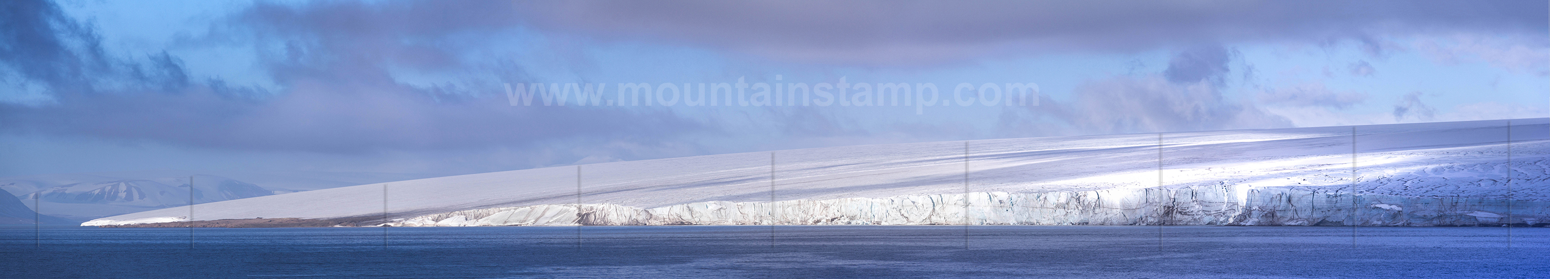
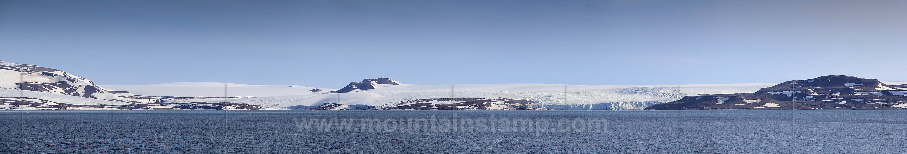
Spitsbergen panorama Hinlopen Strait.
The Valhallfonna Ice cap covers an area of about 1000 square kilometres and is located west of Hinlopenstrait. It is named after Valhall, dwelling of the gods in Norse mythology. (source "The Names of Svalbard", Norwegian Polar Institute).
image (0859 64) size: 15027px x 3312px
Click on the image to enlarge it to full-screen display in panorama viewer.
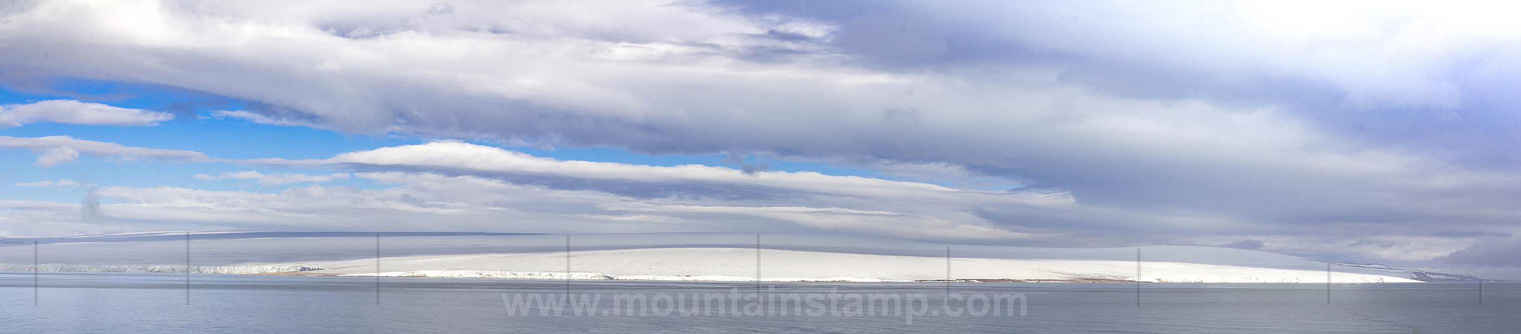
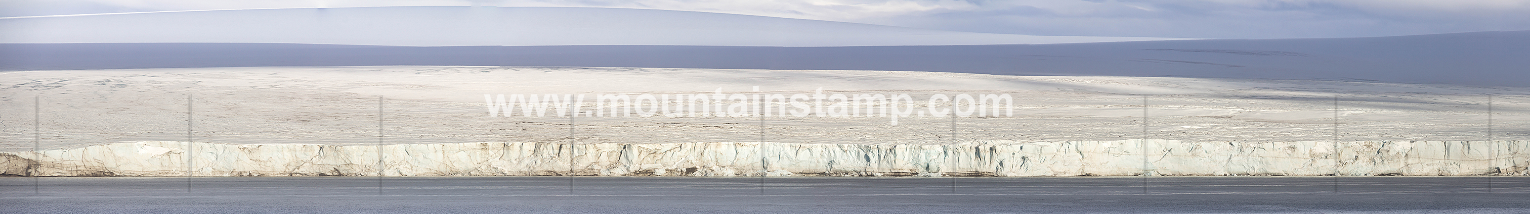
Spitsbergen panorama Hinlopen Strait
The Ice wall of Valhallfonna Ice cap.
image (0810 16) size: 22151px x 3115px
Click on the image to enlarge it to full-screen display in panorama viewer.
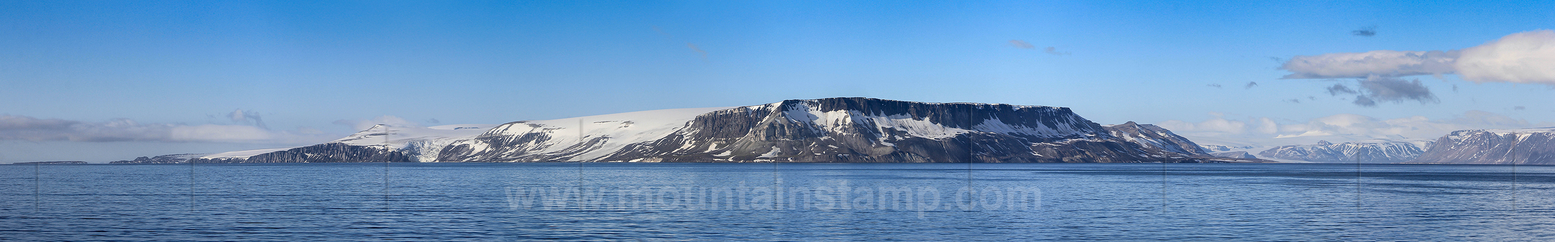
Spitsbergen panorama Hinlopen Strait
Cape Fanshawe (378m) is the northern point of Lomfjordhalvøya, a peninsula between Lomfjorden and Hinlopen Strait. It is a trigonometric point of the Swedish-Russian Are-of-Meridian Expedition 1899-1902. Named after Fanshawe, mate of H.M.S. "Heela", the vessel of Parry's expedition to Spitsbergen 1827.
Alkefjellet (seen at the left) is a cliff northeast on Lomfjordhalvøya and a famous Rookery for sea-fowl. (source "The Names of Svalbard", Norwegian Polar Institute).
image (0865 16) size: 17233px x 2687px
Click on the image to enlarge it to full-screen display in panorama viewer.
Spitsbergen panorama Hinlopen Strait
Draupnerknausane and Tommelbreen glacier on Lomfjordhalvøya peninsula.
Draupnerknausane (named after Draupner, was the finger ring of Odin in Norse mythology) is a row of nunataks and crags in the south of Alkefjellet and along the eastern side of Torsfonna glacier plateau. (source "The Names of Svalbard", Norwegian Polar Institute).
image (1052 58) size: 16002px x 2727px
Click on the image to enlarge it to full-screen display in panorama viewer.
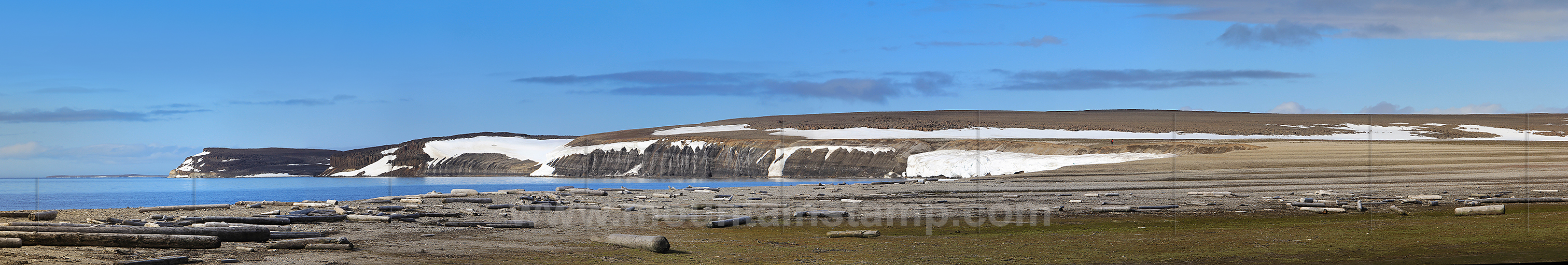
Spitsbergen panorama Hinlopen Strait
Driftwood on Wahlbergøya island. Many of Svalbard’s beaches are covered with driftwood, originated mainly from western and central Siberia.
Wahlbergøya with an aera of 28 square kilometres is the largest of the Vaigattøyane islands, (area 28 km2), in Hinlopenstrait. Named after Peter Fredrik Wahlberg, 1800-77, Swedish botanist and secretary of the Royal Swedish Adademy of Science in Stockholm (1848-66). (source "The Names of Svalbard", Norwegian Polar Institute).
image (1124 29) size: 17907px x 3043px
Click on the image to enlarge it to full-screen display in panorama viewer.
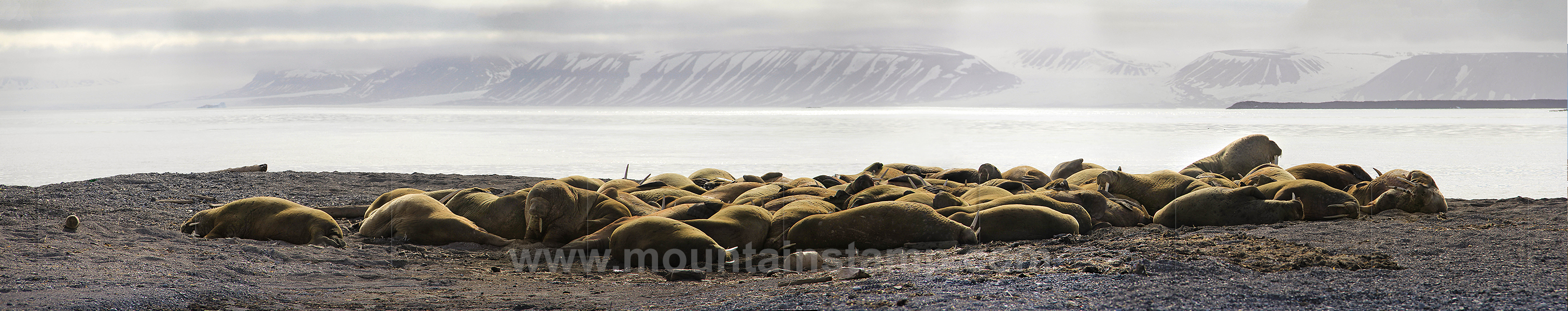
Spitsbergen panorama Hinlopen Strait
Walruses on Wahlbergøya island.
image (1094 98) size: 16535px x 3339px
Click on the image to enlarge it to full-screen display in panorama viewer.
Spitsbergen panorama Hinlopen Strait
A view towards Wilhelmøya Island (seen from the north).
Wilhelmøya Island in Hinlopenstrait (area 120 km2) is named after Wilhelm I (1797-1888), King of Prussia (1861-88), Emperor of Germany (1871-88). About 33,5 % of the island is covered with ice. The highest elevation is Kaisarkampen (seen on the image at the left). The island is seperated from Spitsbergen island by a narrow strait, the Bjørnsundet. (source "The Names of Svalbard", Norwegian Polar Institute).
image (1187 93) size: 15520px x 3665px
Click on the image to enlarge it to full-screen display in panorama viewer.
Spitsbergen panorama Hinlopen Strait
A view towards the narrow northern entrance of Bjørnsundet. Wilhelmøya island (left) and the coast of Spitsbergen island (right).
image (1225 34) size: 29394px x 3278px
Click on the image to enlarge it to full-screen display in panorama viewer.
Spitsbergen panorama Hinlopen Strait
Moltkebreen with Rundemannen mountain, seen from north of the entrance to Bjørnsundet.
Rundemannen is a low mountain in the upper part of the Moltkebreen, the glacier is named after Field-Marshal Count Helmuth von Molkte, 1800-91, German Army. (source "The Names of Svalbard", Norwegian Polar Institute).
image (1225 34) size: 20376px x 3486px
Click on the image to enlarge it to full-screen display in panorama viewer.