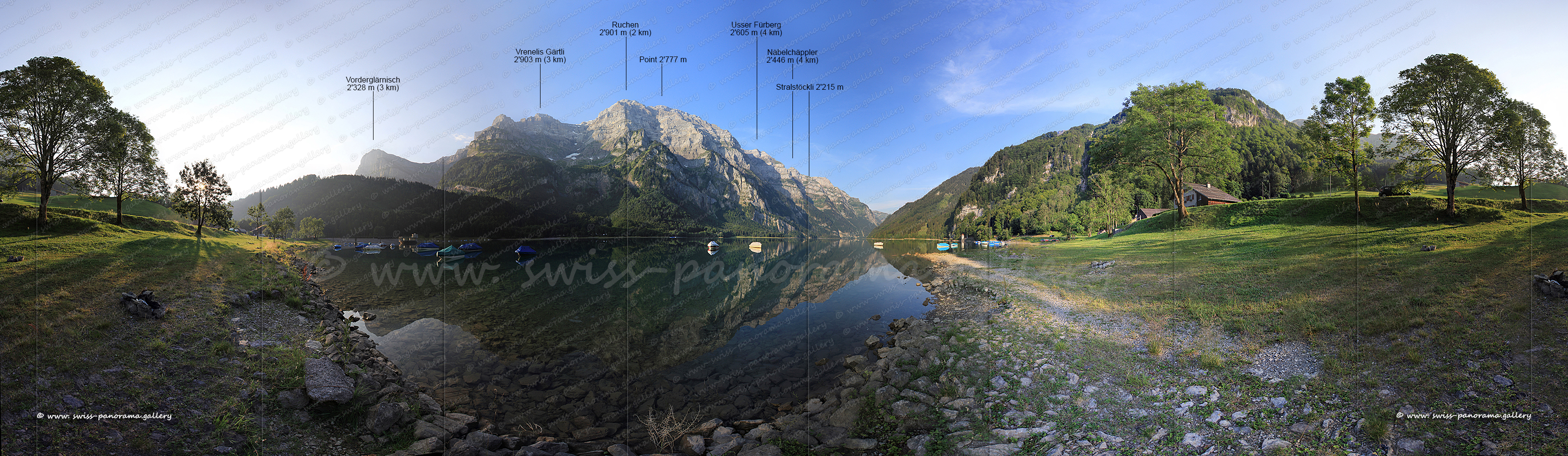
Klöntal
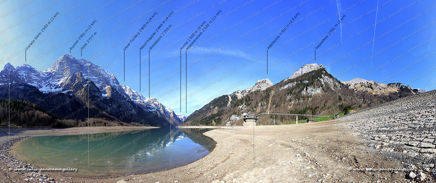
Das Klöntal ist ein kleines Tal westlich der Stadt Glarus. Der Klöntalsee ist durch einen prähistorischen Bergsturz entstanden und wird als Energiespeicher genutzt. Seit dem Bau des Kraftwerks im Jahr 1914 kann der Klöntalsee durch einen zusätzlichen Damm als Wasserspeicher für die Produktion von verbrauchsabhängiger Spitzenenergie genutzt werden. Die imposante Wand des Glärnisch-Massivs erhebt sich steil mehr als 2'000 Meter über dem See.
The Klöntal is a small valley just west of the town of Glarus. The Klöntal lake was created by a prehistoric rockslide and is used as an energy reservoir. Since the construction of the power plant in the year 1914, an additional embankment allows the Klöntal lake to be used to store water for the production of consumption-adjusted peak-load energy. The imposing wall of the Glärnisch massif is rising steeply more than 2'000 metres above the lake.