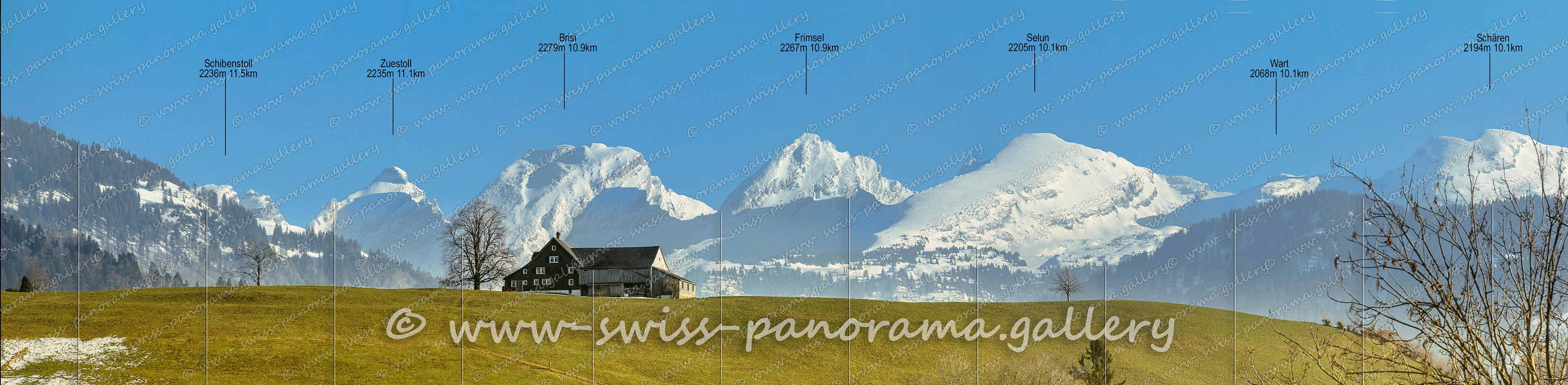
Die Gipfel der Churfirsten aus der Sicht von oberhalb Neu St. Johann im warmen Abendlicht.
Klicken Sie auf das Bild um es im Panorama Viewer zu sehen.
Click on the image to enlarge it to full-screen display in panorama viewer.
Auf Ihrem Desktop oder Tablet können Sie das Bild im Panorama Viewer betrachten.
You can view the image in the panorama viewer on your desktop or tablet.
Das Obertoggenburg bildet zusammen mit dem Nekartal, dem Mitteltoggenburg und dem Untertoggenburg die geografische Region Toggenburg. Der höchste Berg ist der 2502 Meter hohe Säntis im Alpsteinmassiv. Das charakteristische Wahrzeichen des Toggenburgs ist jedoch die Bergkette der Churfirsten.
The Upper Toggenburg forms together with the Nekar Valley, the Middle Toggenburg and the Lower Toggenburg the geographic region Toggenburg. The highest mountain is the 2502 meter high Säntis in the Alpstein massif. However, the characteristic landmark of Toggenburg is the mountain range of the Churfirsten.
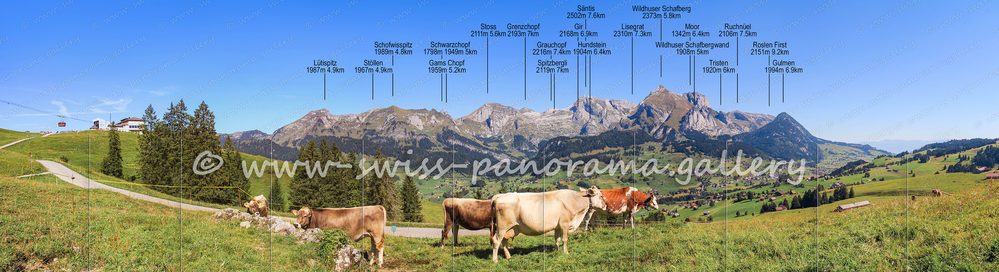
Blick von Iltios auf das Säntis Massiv. Iltios kann erreicht werden über eine Standseilbahn, von hier führt eine Seilbahn weiter auf die Chäserrugg 2264m.
Klicken Sie auf das Bild um es im Panorama Viewer zu sehen.
Click on the image to enlarge it to full-screen display in panorama viewer.
Auf Ihrem Desktop oder Tablet können Sie das Bild im Panorama Viewer betrachten.
You can view the image in the panorama viewer on your desktop or tablet.
180 Grad Weitwinkel Panorama von der Chäserrugg
Klicken Sie auf das Bild um es im Panorama Viewer zu sehen.
Click on the image to enlarge it to full-screen display in panorama viewer.
Auf Ihrem Desktop oder Tablet können Sie das Bild im Panorama Viewer betrachten.
You can view the image in the panorama viewer on your desktop or tablet.
Fernsicht von der Chäserrugg zu den Glarner und Urner Alpen.
Klicken Sie auf das Bild um es im Panorama Viewer zu sehen.
Click on the image to enlarge it to full-screen display in panorama viewer.
Auf Ihrem Desktop oder Tablet können Sie das Bild im Panorama Viewer betrachten.
You can view the image in the panorama viewer on your desktop or tablet.
Morgendliche Überraschung auf der Chäserrugg. Eine Gruppe von 16 Steinböcken entlang des Wanderweges zum Hochplateau Rosenboden.